1507 - 1774
Approximately 500 kilometres east of the Patagonian coast, the Falkland Islands is an archipelago of just over 12,000 square kilometres comprising of two main islands, East Falkland and West Falkland and some 776 smaller islands.
Early History.
First mentions of the islands, comes in 1507, when a group of islands appeared on a map by German cartographer Martin Waldseemuller. During the following century, the islands are mentioned a number of times, including a report from 1521 by Estêvão Gomes, a Portuguese captain with Magellan, some inclusion of some islands on a chart by Pedro Reinel in 1522 and a reported spotting of the islands in 1584 by the English navigator, Cowley.
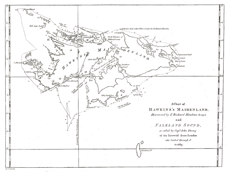
In 1592, Captain John Davis in the Desire was driven by strong winds among, what he thought were a previously undiscovered group of islands. This was followed by the 1594 expedition by Sir Richard Hawkins, who noted a group of islands, some 55 leagues east-northeast from the straits of Magellan. The earliest accurate charting of the islands was around 1600, by Sebald de Weerdt, of the Dutch East India Company.
The first recorded landing was at Bold Cove by Captain John Strong from the ship Welfare, after sailing down the passage between the two main islands on January 29, 1690, He named the passage the ‘Falkland Channel’. Six years later, William Dampier returns and circumnavigates the Falklands.
First Settlements.
The first to build a permanent structure on the islands were the French, under the command of Louis-Antoine de Bougainville, who named the islands ‘Les Iles Malouines’, constructing the Fort St. Louis on East Falkland in early 1764.
The following year, unaware of the French presence, the British ships Dolphin and Tamar arrived on the islands, claiming the islands, based on prior discovery, for the British crown, and establishing a watering place and vegetable garden in a sheltered bay they named Port Egmont.
In August that year, the Spanish, their claim based solely on the Papal grants as described in the Treaty of Tordesillas, demand that the French immediately relinquish all claims and remove all settlers. In Bougainville ‘s opinion, the Spanish claim was invalid; as they didn’t know where the islands were and had not as yet, ever stepped foot on the islands.
In January 1766, under orders from Henry Conway, Secretary of State for the Southern Department, Captain John MacBride arrives at Port Egmont in the Jason, with the HMS Carcass and the store ship HMS Experiment and commences to construct permanent buildings, a garrison and blockhouse.
By October of 1766, under pressure from the Spanish, Bougainville, signs over his claim on the islands and accepts reimbursement of his expenses. It was around this same time that The Spanish also try to exert pressure on the British to relinquish their claim to the islands, by invoking Article 8 of the Treaty of Utrecht. Lord Shelburne, the British Southern Secretary replied that the British claim is based on first discovery and that Britain does not regard Article 8 as a prohibition on discoveries in the South Seas.
In April the following year, Bougainville meets for the official handover of the islands to the Spanish at Port Louis, with Felipe Ruiz Puente, the new Spanish Governor of the Islas Maluinas. A few weeks later, after accepting the handover and planting the Spanish flag at Port Louis, now renamed Puerto Soledad, the new Spanish governor and his ships leave. Bougainville and the last of the Arcadian settlers left in June, thereby abandoning the islands completely.
The British presence on the islands continued, notwithstanding the constant claims by the Spanish until June 10, 1770 when the British forces there surrendered to overwhelming Spanish forces sent from Buenos Aires under the orders of the local Governor. This event quite nearly caused war, between the two nations with Britain preparing a large Naval fleet. Eventually, over a number of months of intense diplomatic negotiation the situation was resolved with the Spanish Crown declaring that they did not authorise the expedition against Port Egmont, or the force used against the British forces and ordering that all things shall be immediately restored to the precise situation in which they stood before the 10th of June 1770.
By 1774, the British garrison departs, leaving behind a Union Jack and a lead plate stating -
‘ Know all the Nations, the Falkland Islands, with its ports, warehouses, landings, natural harbours, land and coves belonging thereto, are of exclusive rights and ownership of his most sacred Majesty George III, King of Great Britain. In testimony whereof, placed this plate and the colours of his British Majesty left flying as a sign of possession by S.W.Clayton, official Commander of the Falkland Islands. 1774 A.D.’
References
http://en.wikipedia.org/wiki/History_of_the_Falkland_Islands (Wikipedia)
http://falklandstimeline.wordpress.com (Lord Ton)
http://www.falklandnews.com (Falkland Islands News Network)
http://www.historyworld.net/timesearch/default.asp (History World)
http://britishempire.co.uk/maproom/falkland/timeline.pdf (Roger Lorton)
http://www.falklands.gov.fk (Falkland Islands Government)
https://www.cia.gov/library/publications/the-world-factbook/geos/fk.html (Central Intelligence Agency)
http://www.newworldencyclopedia.org/entry/Falkland_Islands (New World Encyclopedia)
http://www.worldatlas.com/webimage/countrys/samerica/fk.htm (Woolwine-Moen Group)
Image Credit
http://en.wikipedia.org/wiki/File:Hawkesworth-Byron-Map.PNG
Note: This piece was written as an assignment in a Communication & Media course I am currently studying.
Early History.
First mentions of the islands, comes in 1507, when a group of islands appeared on a map by German cartographer Martin Waldseemuller. During the following century, the islands are mentioned a number of times, including a report from 1521 by Estêvão Gomes, a Portuguese captain with Magellan, some inclusion of some islands on a chart by Pedro Reinel in 1522 and a reported spotting of the islands in 1584 by the English navigator, Cowley.
In 1592, Captain John Davis in the Desire was driven by strong winds among, what he thought were a previously undiscovered group of islands. This was followed by the 1594 expedition by Sir Richard Hawkins, who noted a group of islands, some 55 leagues east-northeast from the straits of Magellan. The earliest accurate charting of the islands was around 1600, by Sebald de Weerdt, of the Dutch East India Company.
The first recorded landing was at Bold Cove by Captain John Strong from the ship Welfare, after sailing down the passage between the two main islands on January 29, 1690, He named the passage the ‘Falkland Channel’. Six years later, William Dampier returns and circumnavigates the Falklands.
First Settlements.
The first to build a permanent structure on the islands were the French, under the command of Louis-Antoine de Bougainville, who named the islands ‘Les Iles Malouines’, constructing the Fort St. Louis on East Falkland in early 1764.
The following year, unaware of the French presence, the British ships Dolphin and Tamar arrived on the islands, claiming the islands, based on prior discovery, for the British crown, and establishing a watering place and vegetable garden in a sheltered bay they named Port Egmont.
In August that year, the Spanish, their claim based solely on the Papal grants as described in the Treaty of Tordesillas, demand that the French immediately relinquish all claims and remove all settlers. In Bougainville ‘s opinion, the Spanish claim was invalid; as they didn’t know where the islands were and had not as yet, ever stepped foot on the islands.
In January 1766, under orders from Henry Conway, Secretary of State for the Southern Department, Captain John MacBride arrives at Port Egmont in the Jason, with the HMS Carcass and the store ship HMS Experiment and commences to construct permanent buildings, a garrison and blockhouse.
By October of 1766, under pressure from the Spanish, Bougainville, signs over his claim on the islands and accepts reimbursement of his expenses. It was around this same time that The Spanish also try to exert pressure on the British to relinquish their claim to the islands, by invoking Article 8 of the Treaty of Utrecht. Lord Shelburne, the British Southern Secretary replied that the British claim is based on first discovery and that Britain does not regard Article 8 as a prohibition on discoveries in the South Seas.
In April the following year, Bougainville meets for the official handover of the islands to the Spanish at Port Louis, with Felipe Ruiz Puente, the new Spanish Governor of the Islas Maluinas. A few weeks later, after accepting the handover and planting the Spanish flag at Port Louis, now renamed Puerto Soledad, the new Spanish governor and his ships leave. Bougainville and the last of the Arcadian settlers left in June, thereby abandoning the islands completely.
The British presence on the islands continued, notwithstanding the constant claims by the Spanish until June 10, 1770 when the British forces there surrendered to overwhelming Spanish forces sent from Buenos Aires under the orders of the local Governor. This event quite nearly caused war, between the two nations with Britain preparing a large Naval fleet. Eventually, over a number of months of intense diplomatic negotiation the situation was resolved with the Spanish Crown declaring that they did not authorise the expedition against Port Egmont, or the force used against the British forces and ordering that all things shall be immediately restored to the precise situation in which they stood before the 10th of June 1770.
By 1774, the British garrison departs, leaving behind a Union Jack and a lead plate stating -
‘ Know all the Nations, the Falkland Islands, with its ports, warehouses, landings, natural harbours, land and coves belonging thereto, are of exclusive rights and ownership of his most sacred Majesty George III, King of Great Britain. In testimony whereof, placed this plate and the colours of his British Majesty left flying as a sign of possession by S.W.Clayton, official Commander of the Falkland Islands. 1774 A.D.’
References
http://en.wikipedia.org/wiki/History_of_the_Falkland_Islands (Wikipedia)
http://falklandstimeline.wordpress.com (Lord Ton)
http://www.falklandnews.com (Falkland Islands News Network)
http://www.historyworld.net/timesearch/default.asp (History World)
http://britishempire.co.uk/maproom/falkland/timeline.pdf (Roger Lorton)
http://www.falklands.gov.fk (Falkland Islands Government)
https://www.cia.gov/library/publications/the-world-factbook/geos/fk.html (Central Intelligence Agency)
http://www.newworldencyclopedia.org/entry/Falkland_Islands (New World Encyclopedia)
http://www.worldatlas.com/webimage/countrys/samerica/fk.htm (Woolwine-Moen Group)
Image Credit
http://en.wikipedia.org/wiki/File:Hawkesworth-Byron-Map.PNG
Note: This piece was written as an assignment in a Communication & Media course I am currently studying.
 RSS Feed